

Today started off with a mess, that actually began last night. While I was talking to my wife, I was surprised by a message that I had one minute left on my cell phone. I was shocked since I didn’t even know that I was being charged for talking to her after 6:00 pm. Once I found a place to get online in Bouctouche this morning I made the painful discovery that all my prepaid minutes had been exhausted over the last few days by long distance charges since I’m no longer in the same local calling area as her. Next I had to find a place to buy more minutes since my wonderful cell phone company refuses to accept an American credit card. And I was unable to call up customer service to complain because their live support only begins at 8:00 am Eastern time (9:00 here). Not a nice way to spend the first couple hours of the day.
Finally, I had Kevin drive me up the Bouctouche River to Ste.-Marie-de-Kent. We agreed that the area had a very European feel. It was nice to see that there was a little park and boat ramp next to the bridge. It said that “non-members” were supposed to pay for use, but there was nobody around to pay. The river was quite wide and peaceful and beautiful. There were oodles of homes in view, and I quickly felt overwhelmed by the lostness of these more inland rural areas. Before too long I came to the Bouctouche/Puktusk Micmac reserve, but almost all homes are along the road, away from the river. As I came into Bouctouche itself, I was again struck by the immensity of the harvest field and wanting to know more of the breakthroughs that the local Pentecostal church has seen. Unfortunately though, I had no success at making contact with the pastor. I later found out that he was out of the country for the week.
After my lunch break at a rock across from Bouctouche, I moved on southward into Bouctouche Bay and then the open gulf. The weather stayed nice, and my next concern was to get around the Bar de Cocagne and the west side of Cocagne Island. The bar was a bit of a disappointment, but the island was impressive. My concern was that I was going into uncharted waters. Literally. The nautical charts for the area show the area between Cocagne Island and the mainland as blank, with no tidal areas, depths, etc. So I was afraid that it might be a giant shifting sand trap that doesn’t have enough water to be reliably navigable even by a kayak. Instead, it turned out to be fairly deep (although with lots of sea weed stuff) and even had some boats moored in it. There were also aquaculture plots in some areas.
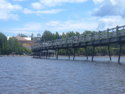
Once I got past the closed Cocagne bridge, I was again not able to see the campground where I expected it. It turned out to be up a bluff and across the road. Since it was Wednesday and not too too late, I thought it might be good to drive into Shediac and see if we could find a prayer meeting at a one of the churches. Apparently, the Vances had spent much of the day aggravated at trying to follow a crazy road system that was exacerbated by the closed bridge. We made a few wrong turns going to Shediac before coming across the Baptist church, which had changed to meet at the United church’s building. No one was around, and we went on to get some supper and groceries. I got a huge delicious donair that really hit the spot, while the Vances shared a big pizza. Driving back to Cocagne, we talked about plans for the Vances’ departure, stared at the giant lobster by the Shediac information center, and saw a beautiful sunset through light rain in the distance.
No comments:
Post a Comment